
Residential
/
Revolutionizing Residential Spaces with Imaging Precision
A home is more than a place—it’s an investment, a vision, and a future. Whether buying, selling, or renovating, homeowners and developers need accurate insights to make confident decisions. With rising costs and tight timelines, clarity matters more than ever.
At Ingenium Imaging Solutions, we bring homes to life with advanced imaging and 3D modeling—offering precise floor plans, virtual walkthroughs, and drone-based property visuals that empower clients to plan smarter, sell faster, and build with confidence.
How Our Technology Integrates


Solutions We provide

Centralized Home Intelligence
Aggregate up-to-date floor plans, appliance locations, infrastructure layouts, and spatial data into one dashboard for seamless access by homeowners, designers, and contractors.
Faster Renovation Planning
Leverage high-accuracy 3D scans and annotated visuals to replace manual measurements, cut site visits, and accelerate design and permitting for home remodels.

Equipment & Asset Verification
Standardize visual documentation of HVAC units, appliances, electrical panels, and plumbing fixtures to streamline maintenance, warranties, and future upgrades.
Remote Property Assessment
Conduct immersive virtual walkthroughs and drone-captured aerial views to evaluate conditions, plan renovations, and perform pre-purchase inspections without an on-site visit.
Utility & Infrastructure Clarity
Provide detailed maps of piping networks, cable trays, and utility corridors—pinpointing valves, junction boxes, and service access points to prevent unplanned outages.
Scalable Multi-Home Surveys
Coordinate one-off surveys or entire neighborhood rollouts with uniform data standards, consistent deliverables, and centralized project tracking for builders and developers.
Custom Outputs for All Stakeholders
Provide tailored CAD floor plans, BIM-ready models, PDF markups, or virtual tours to meet the exact needs of homeowners, architects, contractors, and inspectors.
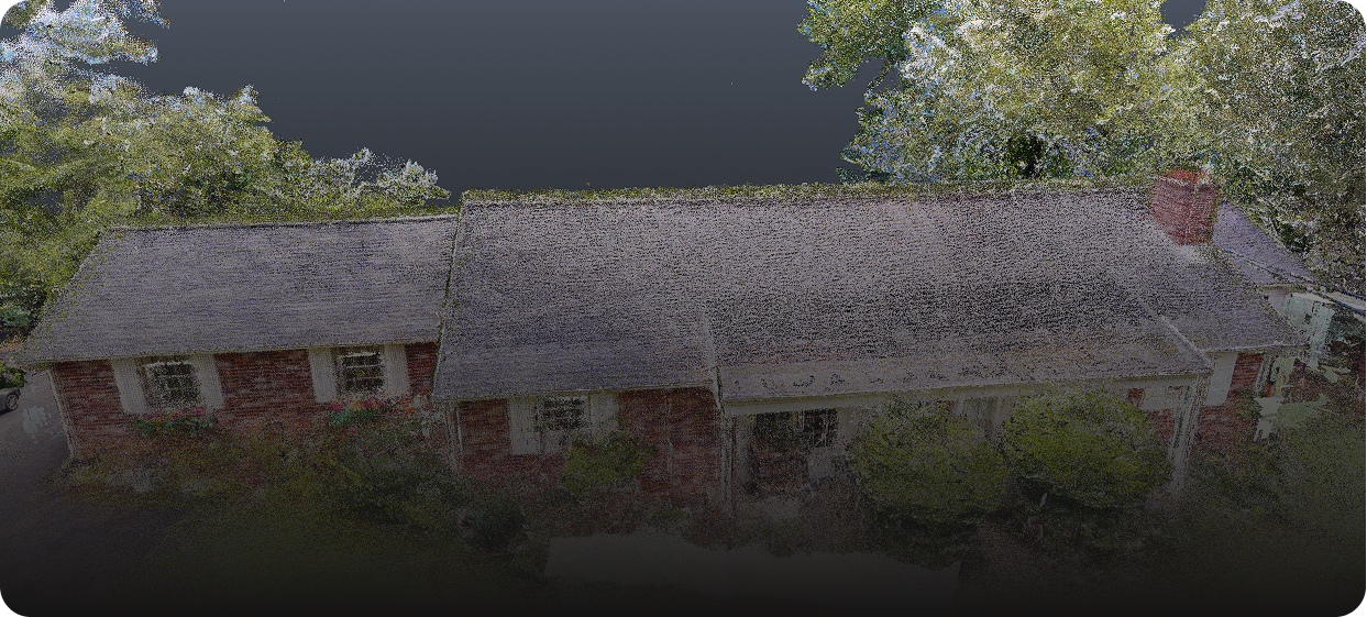
CASE STUDY – 97 Stenton Ave case study
Smarter Documentation. Better Accuracy.
At 97 Stenton Ave in Plymouth Meeting, Ingenium Imaging Solutions delivered a full LOD 300 Revit model and CAD plans using the Matterport Pro3, Leica BLK360, and drone capture. By combining precision LiDAR with rapid 3D scanning, the team created a unified digital twin of the property. This approach reduced on-site time by 40% and provided design teams with models accurate to within ±5 mm, ensuring confidence for renovations and planning.
Up to
reduction in on-site time
Up to
lower survey costs versus traditional approaches
Benefits of Our
Services
Insightful Home Imaging. Bringing every detail of your living space into clear focus.
A powerful advantage for homeowners, Ingenium Imaging technology provides high-resolution home imaging and real-time data analysis. From drone surveys to precise 3D models, we help you make informed renovation decisions that streamline planning, cut costs, and enhance your property’s value.
Smarter Home Efficiency
Optimize every renovation resource—labor, materials, and time—with precise home imaging that drives down waste and maximizes your project’s return.
Cost Saving
Detect household issues early, reduce material waste, and safeguard your home from costly repairs before minor problems escalate.
Boosted Productivity
Harness precise home imaging and actionable data to streamline renovation workflows, minimize project delays, and maximize contractor efficiency.
Sustainable Practices
Utilize precise home imaging to plan energy-efficient upgrades and water-conserving improvements that minimize environmental impact and ensure long-term comfort.
Explore the tools that help you gain better data insights.
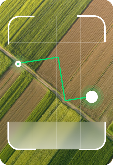
Advanced Drone & Sensor Technology
High-resolution RGB, multispectral, and thermal sensors capture detailed aerial imagery, revealing crop health, moisture levels, and soil conditions with unmatched precision.
Cloud-Based Farm Monitoring
With real-time dashboards and historical data tracking, monitor field conditions from anywhere and predict yield outcomes to optimize planting and harvesting.

AI-Driven Data Analytics
Our AI-powered processing transforms raw images into actionable insights, identifying disease, nutrient deficiencies, and growth patterns for smarter decision-making.